Geographical Position
by K.V.Gregoritchev
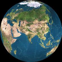 Altai Territory is situated in the center of Eurasia, the largest continent of the Earth. It occupies the south-eastern borderlands of the West Siberian Plain and a significant part of the Altai Mountains area. Lying between the 51-54 of Northern latitude and 78-86 of Eastern longtitude in temperate zone, it stretches from South-East to North-West nearly for 1000 km. Its south-eastern borders run almost through the centre of Asia. It spans for 560 km from West to East and for 500 km from North to South. The distance between Barnaul, the administrative centre of the Territory, and Moscow is 3419 km.
Altai Territory is a part of the West-Siberian economical region. Its area is 168,0 thousand sq. km, population (the begining of 1994) is 2 684 300 people, including 1 401 200 people in urban areas and 1 283 100 in rural areas. Among other Russian administrative territories and regions Altai territory is the 12th in area, and the 16th in population.
Relief
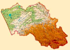
There are several relief zones distinguished in Altai Territory. The western part occupied by flat and barely sloped Kulundinskaia Plain is the lowest area of the territory (the least altitude is 96 m above sea level). In general it is similar to a giantic bowl with a large Kulundinskoie Lake in the centre. A few rivers running through this area (Kulunda, Burla, Suietka, Kuchuk) have shallow valleys, meandering riverbeds, small and wide terrace ledges.
Further to the East rises a distinct elevation of Priobskoie Plateau with a think network of gullies and ravines, where small brooks make their way. The maximum altitude of the plateau is 321 m. The main feature of its relief is parallel hollows with riverbeds of former large glacier-originated streams. The hollows stretch from North-East south-westwards. They are up to 20 km wide and 50-100 m deep. There are contemporary rivers (Barnaulka, Kasmala, Aley, Burla, Kulunda) or lakes stretched in line in most of the hollows. Well-drained lakes are fresh and the ones without outflow are either salt or bitter-salt. Close to the largest river of the region, Ob, the plateau's surface is scarred with ravines, gullies, and riverbeds.
Beyond the wide Ob's valley, in the northern part of the region
Byiski-Chumishsky Hillsare situated (300 - 500 ě
high), merging eastwards into Predsalairsky plain
(200 - 300 ě high). Hills of these areas are scarred with ravines. Thick network of small rivers (Chumish, Eltsovka and others) belongs to the Ob river system.
The undulating relief of a low-rising (400 - 500 ě)
Salairsky Ridge situated in the north-eastern part of the territory is scarred by numerous streams. The ridge is shaped into arc about 300 km long bulging north-eastwards. The south-western face of the ridge is more sloped then the north-eastern. Its surface consists of broad valleys and hills.
A line of Altai flat foothills occupies the central part of the Altai Territory. Their arc stretches for over 200 km buldging to north-west. The main regional tributaries of Ob, rivers Charish and Alei, flow here. Undulating relief of the area combining with a developed river system makes this zone one of the most furtile zones of the region.
This line of foothills separates Western Siberia from Altai mountains. Only the northern part of this mountainous area lies within the territory. These are Kolivansky and Tigiretsky ranges and the northern ends of the Korgonsky, Baschelaksky, Anuisky, Cherginsky and Seminsky ranges.
Climate
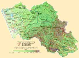
Altai Territory has a continental climate with cold, long, snowy winters and short, warm, sometimes hot summers. The hottest summer month is July. Its average temperature in mountain areas is +6-7°Ń and +20°Ń in flat areas. In daytime the air can warm up to +25-40°Ń. At nights dew is usual, and towards the end of summer even hoar-frosts occur. The maximum summer temperature is +40°Ń. The winter averages differ from -17-18°Ń on plains to -21-25°Ń in mountains. Winter minimum falls down to -50°Ń. Continuous frosts up to 130-160 days long define a long heating period lasting 200-260 days
Altai Territory is one of the most sunny regions of Western Siberia. Its north receives the same amount of sunshine as the central Ukraine, and its south-west (in Rubtsovsk area) is similar to Southern Crimea in this characteristics. However the most of fine days are in the winter season. About 70% of annual percipitation fall on summer period and thunderstorms (sometimes with hail) are frequent in summer months.
Vegetation
The flora of Altai is characterised by abundance and variety. The complex combination of climate and relief resulted in several types of lanscape found within quite small area of the territory. The descending levels going from east to west are manifested in vegetation ranges, too. In western areas the common type of landscape is feather-grass stepps, in Ob area it is meadow stepps with birch and aspen groves. In Altai foothills with hills and spures of mountain ranges unique ecological zones with special microclimate are formed. Rare and unusual in Siberia plants grow in these conditions such as cherry-trees, vine, etc. On the south-west of the territory where the northern part of Altai mountain system lies the Alpine zone is formed. The top part of mountains is covered with snow and ice. Separate spots of vegetation are found below. This mountain zone is within reach of only mountain-climbers and well-trained tourists.
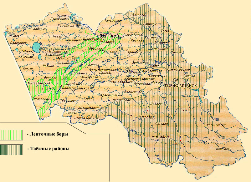
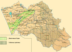
Altai's treasure is its woods. Mostly the northern and central area of the territory is occupied with small forests of birches and aspens, so called gullies. Most of the woods are situated in the north-eastern and eastern regions, mainly so-called "black taiga" consisting of pines, firs and larches. There are also pure pine forests such as unique pine forest belts crossing the stepp zone. These forest belts are 3-4 km to 10-12 km wide and several hundreds kilometres long. They are bound to the ancient river-beds with fine sand ground. Neighboouring with the stepps stipulated in stepp vegetation getting under the forest curtain